Martindale consists of a cluster of valleys on the eastern shore of Ullswater. It can be reached from Pooley Bridge either by ferry to Howtown or by the road which also passes through Howtown and then up a steep zig zag section of narrow road called Hallin Hause. The road from Pooley Bridge is narrow with few passing places and this can be a frustrating journey under Summer traffic conditions. Two walking routes to Martindale exist, both from Patterdale. The first crosses Boredale Hause and involves a steep climb; the second follows the shore of Ullswater for a pleasant and less energetic 5 miles to arrive at the small hamlet of Sandwick. The population of Martindale is now only around 50 people in Winter, distributed amongst a scattering of farms, houses and small hamlets. Two hundred years ago the population was around 200 people and since then it has slowly declined. Martindale is a very interesting and beautiful place, almost unchanged over the centuries.
The following photo shows the rich early autumn colours of Hallin Fell which dominates the northern entry into Martindale. The view is looking down onto Howtown Bay where the pier for the ferry can be found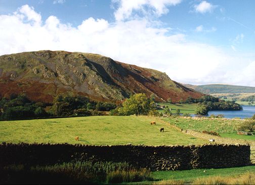
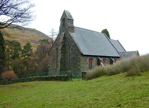
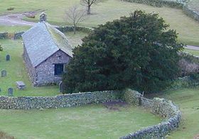
There are two very interesting churches in Martindale which are well worth a visit especially on a day when it may be too wet to walk. St Peter's church is the more modern, dedicated in 1882. It is located just above the hause where the ground starts to level out. The following photo shows this church with Hallin Fell in the background.
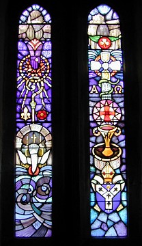
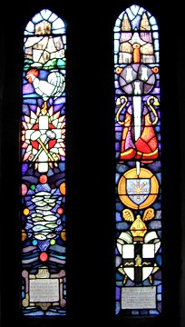
The interior of the church is quite plush and one gets the feeling that it is really well looked after. The most striking features inside are the stained glass windows. They are all relatively modern, dating from 1975 and designed by Jane Gray, a lady who is certainly accomplished in the use of colours. Each window holds a story which is related in the booklet about Martindale edited by C.N.Barrand, a former parish priest and which should be available locally. Most of the windows represent Saints. The pair of windows in the following right hand photo represent St Peter with the net of fishes and St Martin with his sword and cloak and also the coat of arms of Tours his home town.
 |
 |
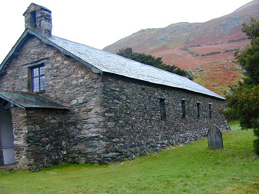
St Martin's church is less than 1km south of St Peter's following the left fork of the road. Again in a splendid isolated setting. This was the parish church until 1881 when apparently the building was in such a state of disrepair that the roof fell in. Since then restoration in a simple manner has taken place. The churchyard of St Martins is still used for burials and fresh flowers are often present in the old church. It is believed that it was built in the latter part of the 17th century, although a church has always been on this site for at least 700 years.There are written records referring to St Martin's chapel in the early part of the 13th century, However, there is also a yew tree in the churchyard which could be as old as 1300 years, suggesting a church may have been present for this length of time. An excellent information sheet inside the church porch explains the church's history. The following photo shows St Martins church.
The yew tree at St Martins is certainly a large tree as shown in the following photo. It has large spreading pendulous branches and a trunk consisting of multiple stems. Very ancient yew trees often have a hollow centre surrounded by multiple trunks, but this one does not. It is possible that it still may be very old because of the slower climatic growing conditions.
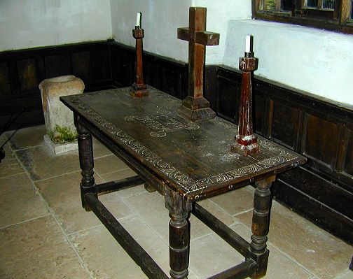
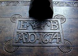
The inside of St Martins church is laid out in a simple but effective manner. The altar is a table which is dated 1674 and the altar furnishings consist only of a simple wooden cross and a pair of plain wooden candlesticks. In the corner next to the altar is a stone font which apparently was brought down from the roman road of High Street which ran along the fell tops. This font was originally a standing stone believed to be at least 1700 years old. It was originally used by the locals to sharpen tools but was later hollowed out and used as a font. The marks from the tool sharpening are still visible. The altar table and font are shown in the next photo.
.
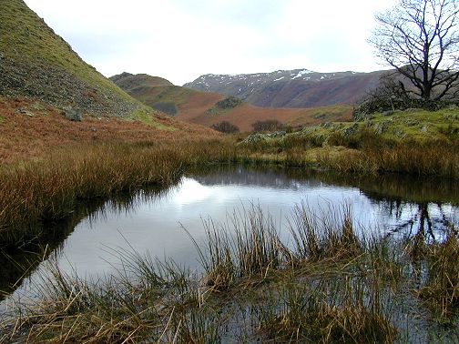
Gowk is the cumbrian word for fool or cuckoo and the possibility exists that you may see both on this walk! The walk begins from the car park at St Peter's church by following the track alongside the church and then bearing right at Lanty Tarn. As you gain a little height the panorama of Martindale opens out before you. Below you are the delightful cottages of Cotehow with the roof coated in emerald green mosses. Beyond is Howegrain Beck and a glimpse of Ullswater at Sandwick.
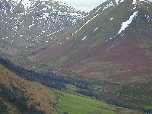
The track is easy and climbs very gradually. Ahead lies the domed end of the Nab which is the prominent feature of this walk.The Nab is part of Martindale deer forest and the chances of seeing deer in the Martindale area are quite high. Apparently this population of red deer are now almost the only pure bred population of red deer in Britain. Most other populations have suffered from hybridisation with introduced sika deer.It is also worth keeping an open eye for golden eagles as well as the more commonly encountered ravens. It is possible that the presence of the red deer has attracted the golden eagles which nest in the immediate area.The following photo is taken from above St Martin's church and shows the Howe Grain valley with The Nab and also Thrang Crag farm nestling in the northern shadow of the crags of Beda Head. This farm must experience it's first rays of summer sunshine somewhere around June.
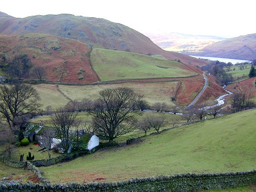
A little further along and the two other valleys, which join to form the Howe Grain valley become more prominent. These are Ramps Gill on the left and Bannerdale on the right. Access to both of these valleys and to The Nab is restricted in order to minimise disturbance to the deer. The fellside woodland in Ramps Gill is botanically quite important as it is one of the few remaining areas of mixed alder woodland growing in a fellside location. Apparently pollen records show this woodland type to be much more common in the past. A population of red squirrels is present in this isolated patch of woodland. The following photo shows how over the centuries the sloping fellside up from the valley has been reclaimed for agriculture. These areas of enclosed field systems are called intaks and in many parts of the Lake District changes in farming methods have meant that they have become less important and they have been allowed to revert to their former state.
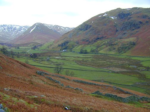
The following photo shows Ramps Gill. In the bottom of this valley is a rather strange building with a bright red roof and green walls. This is called The Bungalow and was used as a hunting lodge by the Earl of Lonsdale and his guests one of whom apparently was 'Kaiser Bill'. It has been said that the Earl and his guests were ferried back and forward through Martindale in one of the Earl's bright yellow Rolls-Royces. A smaller version of The Bungalow also exists further up the valley which was used as the stalker's residence.
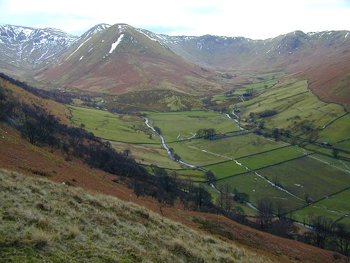
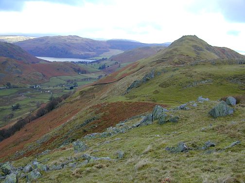
The walk has now passed through a narrow wooden gate in a stone wall and has reached the ridge top. On 8th January 2001 there were about 8 or 9 ravens on the top of this ridge. They were very vociferous and were carrying out courtship behaviour. Pairs of them were each mirroring the others flight behaviour and some were even flying upside down in order to accomplish this to perfection. Ravens breed very early in the year and can start to lay eggs during February. The following photo shows the view looking back towards Pikeawassa where the ravens were. A little further on the ground becomes quite boggy and the path becomes difficult to follow.
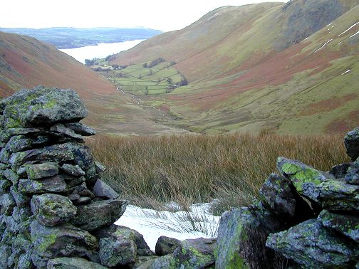
The walker now has several choices; He can walk down the slope heading west to pick up a track contouring the hillside just above the patches of woodland and from there back to the old church of St Martins and back to the car following the road. A good alternative is to carry on until the track passes through the stonewall once more and then bear off to the left to pick up a track which follows Fusedale Beck down towards Howtown, bearing left just before Howtown this track brings you back to St Peter's church and the car park. The following photo is the view down Fusedale towards Howtown.

.
If you have enjoyed looking at this Lake District section please send me an email with your comments. If you have any unusual information about any of the places either past or present or suggestions for other areas I should include please click on email link d.hickson@btconnect.com
Last updated 11th Jan 2001